")

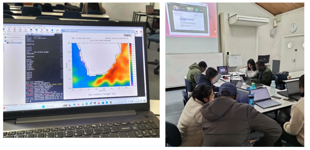
The HYCOM model (Hybrid Coordinate Ocean Model) is a highly sophisticated, global ocean circulation model designed to simulate ocean currents, temperature, salinity, and other oceanic processes. It combines different types of coordinate systems to capture various features of the ocean more accurately, especially in complex regions like the coastal zones, deep oceans, and regions with strong stratification.
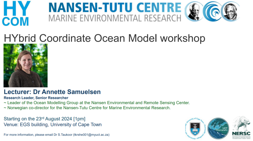
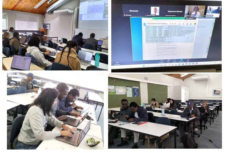
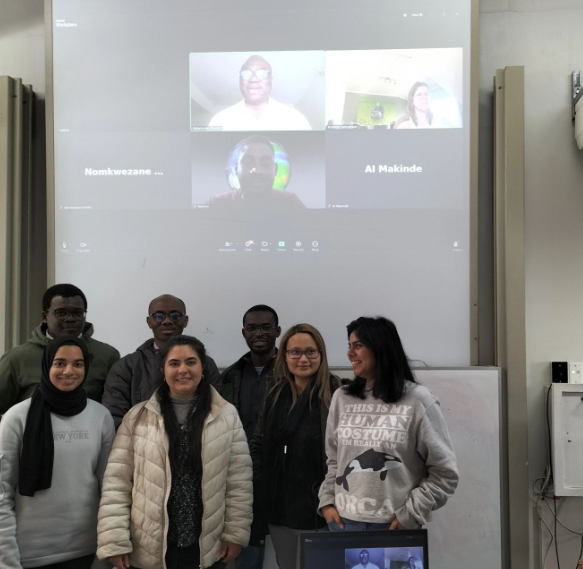
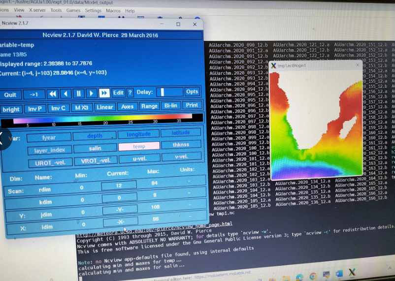
During August and September 2024, Dr Annette Samuelsen, the co-director of the Nansen-Tutu Centre has been lecturing UCT students and postdocs how to generate simulations of Hycom model. About 15 students attended the workshop and ran the model successfully. The next session will now be focused on the atmospheric forcing and the configuration of the grid.
The HYCOM model can be highly beneficial in South Africa, particularly in the context of its unique oceanographic features and environmental challenges. Here are several ways it can be useful:
1. Agulhas Current Research and Prediction
- South Africa is home to the Agulhas Current, one of the strongest western boundary currents in the world. The HYCOM model can help simulate the current’s behavior, including its meandering and retroflection, providing valuable insights for regional climate modeling, ocean circulation studies, and understanding how the current interacts with the global ocean.
- Improved modeling of the Agulhas leakage (the transport of warm water from the Indian Ocean into the Atlantic) can help better understand its role in the global thermohaline circulation and climate regulation.
2. Climate Change and Marine Ecosystem Studies
- HYCOM can assist in studying ocean-atmosphere interactions, particularly how climate change impacts ocean currents, sea level rise, and coastal systems. This is especially important for South Africa’s coastal regions, which are vulnerable to rising sea levels and changes in ocean currents.
- It can help assess marine ecosystem responses, such as shifts in fish migration patterns and plankton productivity, which are crucial for fisheries management.
3. Marine Resource Management and Conservation
- South Africa’s marine biodiversity and fishing industry can benefit from HYCOM by providing high-resolution forecasts of ocean conditions, helping to track fish populations and predict potential risks to marine habitats.
- It can be used in marine protected areas (MPAs) to understand how ocean currents distribute larvae, nutrients, and pollutants, enhancing conservation efforts.
4. Operational Oceanography and Weather Forecasting
- HYCOM’s data can be integrated into South Africa’s marine and weather forecasting systems. It can support operational models for storm surge predictions, coastal flooding, and wave dynamics, especially important for disaster preparedness in coastal areas.
- It can also assist in search and rescue operations by predicting ocean currents and drift paths, helping to locate vessels or debris.
5. Regional Ocean Prediction Systems
- The South African Weather Service and the Department of Environmental Affairs could use HYCOM to enhance their regional ocean forecasting systems. This includes predicting sea surface temperature (SST) anomalies, upwelling events, and marine heatwaves, which impact marine life and local economies.
6. Oil Spill and Pollution Tracking
- HYCOM can model the movement of pollutants and oil spills in South African waters. With the country’s extensive shipping routes and offshore oil exploration activities, HYCOM simulations can provide critical information for environmental protection and mitigation strategies.